What is killing California’s trees, and what can you do about it?
The great thing about living in a major port city such as Los Angeles is having access to ideas and goods from the around the world. Though the port of LA, and by extension every trade conduit branching off from there, takes the chance on cargo containers carrying an invasive species. In 2003 on such species, the polyphagus shothole borer(PSHB), was spotted in Whittier, a suburb of Los Angeles. In the intervening decade it has quickly spread to many of the trees in southern California.

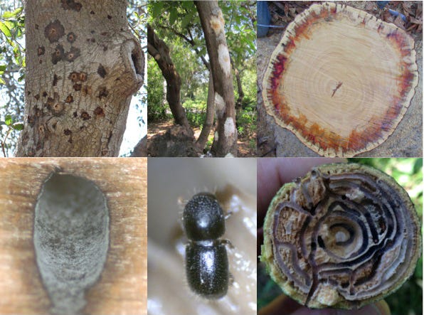
The beetles themselves are small, only a few millimeters long, but they carry fungal spores with them which quickly magnifies the impact of their burrowing. Some trees, for reasons not yet known, are more susceptible to the effects of the burrowing and associated fungal infections. These trees, such as coast live oak and avocado, will play host to a beetle infestations and eventually die before as the beetles go on to infect the surrounding trees.
Our best guess is that these beetles originated in southeast Asia, and then arrived on lumbers shipments through the port of Los Angeles. Beyond that there are a number of outstanding questions: What kept them in check in their native environment? What environmental triggers are behind their spread? Why are some tree species immune to their spread? In the meantime their spread is beginning to threaten both the economy, through the infection of avocado trees, as well as the ecology, through the devastation to native box elder populations.
What can be done? Given the scope and speed of the problem a lot of basic data is needed relatively quickly. Even photographing infected trees, then tagging the images with the time and location of the siting, can build a picture of what factors may be involved the spread of PSHB. When this basic information is merged with data on trees types and local weather records then deeper scientific questions can be addressed: What temperature and humidity range do the beetles prefer? Are they more likely to spread along local wind currents or road networks? Are some trees better hosts to their spread than others?
To collect this data we have started the SCARAB (Scientific Collaboration for Accessible Research About Borers) project. Using the iNaturalist mobile app anyone can help map the spread of these infestations so that we can better understand how to manage them.
To help with this project please take the following steps:
- Set up an account with iNaturalist online, then join the SCARAB project.
- Download the iNaturalist app onto your phone. It currently works for Android and iOS.
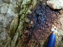
- Look for infected trees. Spotting their presence is relatively straightforward as the fungal infections they carry form dark stains across the tree bark near boreholes of about a millimeter in diameter (The above photo, with a ballpoint pen near the borehole, gives some scale to this.).
- Take a photo of the infected tree, as well as a closeup shot of a borehole near a fungal stain. For the closeup shot please include a ruler or pen near the borehole to give a sense of scale.
- Tag the image with the collection data and GPS location.
- If possible, please record the type of tree infected.
Each individual may not need to take that many photos, but taken together this data may be able to help save a number of our local trees.
Questions or comments? Please contact me at levisimons@gmail.com .
(Originally published here on December 17th 2014)

Comments
Post a Comment